
Executive Order No. 78 Separating Calatagan from the Municipality of Balayan
The western Batangas municipality of Calatagan was acquired from the Spanish crown by Domingo Roxas in 1829 and used to be called Hacienda...

The western Batangas municipality of Calatagan was acquired from the Spanish crown by Domingo Roxas in 1829 and used to be called Hacienda...
Among the Province of Batangas’ most important heritage sites are two lighthouses in Calatagan and Lobo. A July 1903 Executive Order 1 s...
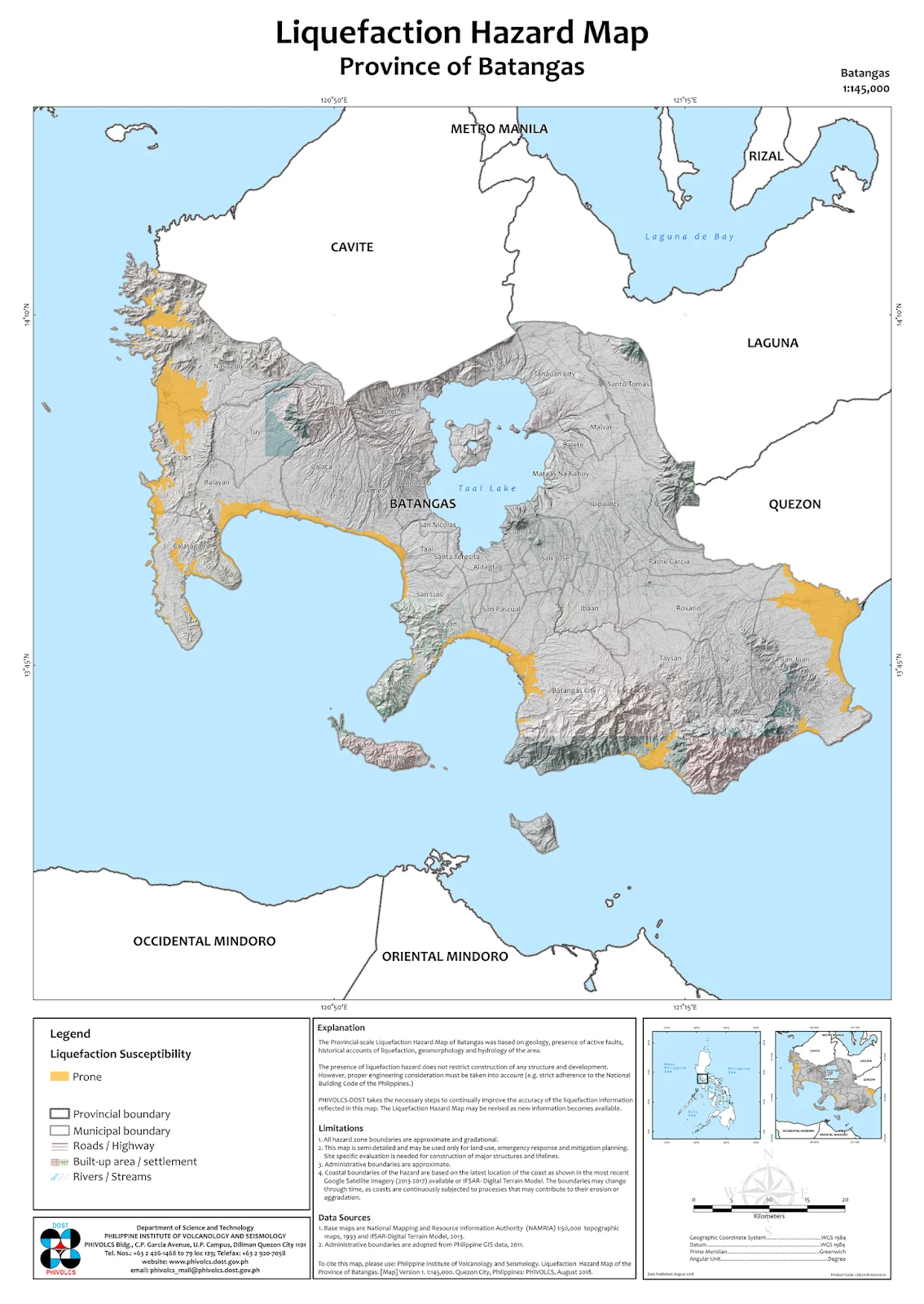
Image source: Philippine Institute of Volcanology and Seismology. Above is the Liquefaction Hazard Map for the Province of Batangas origi...
Santo Tomas is the Province of Batangas’ fourth and newest city, converted from a municipality in 2018. It is Batangas’ northernmost geo-...
In 1912, an executive order 1 was passed reserving land in the barrio of Botong in Taal, Batangas for school purposes. The executive ord...
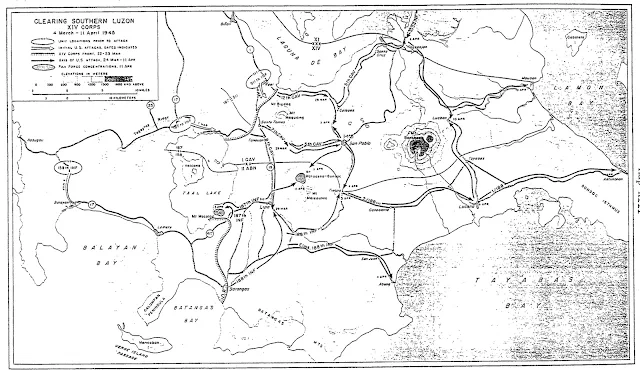
The map below shows the movement of United States Army troops in Batangas in early 1945. Its title is “Clearing Southern Luzon XIV Corps.”...
In 1912, a parcel of land was reserved by the American Colonial Government for school use by way of Executive Order No. 97, signed by Newt...
The present-day district or area in Batangas City that people to this day still refer to as Camp McGrath used to be an installation of the...
The western Batangas coastal town of Lian is in the present day a 3 rd income class municipality with a land area of 3,119.75 square kilo...
The present-day Municipality of Tingloy was like a volleyball being tossed from one town to the other during the American colonial era. In...