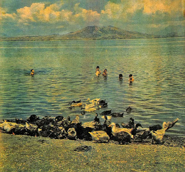
Taal Volcano Island Seen from Agoncillo, 1962
The photograph below has been extracted from an April 1962 edition of The Chronicle Magazine1. The copy is part of the Basilio J. Valdez Digital Collection available online at the Internet Archive. This collection consists of “important papers, letters and memoirs covering the Commonwealth, World War II, and Post-War eras of the Philippines.”
In the inside cover of the magazine, the photograph has been captioned as: “The ducks and children enjoying sun and lake water in our cover picture was photographed at the barrio of Subic, municipality of Agoncillo. Agoncillo is a newly created town2 on the shores of Lake Taal.
To improve the quality of the scan, the converted .jpeg file above has been processed using graphics editing software.
Notes and references:
1 “The Chronicle Magazine, Volume XVII, Number 16,” published 21 April 1962, online at the Basilio J. Valdez Digital Collection, Internet Archive.
2 The Municipality of Agoncillo formally separated from Lemery in 1949. “Agoncillo, Batangas,” Wikipedia.
In the inside cover of the magazine, the photograph has been captioned as: “The ducks and children enjoying sun and lake water in our cover picture was photographed at the barrio of Subic, municipality of Agoncillo. Agoncillo is a newly created town2 on the shores of Lake Taal.
 |
| Taal Volcano Island and Taal Lake seen from |Barrio Subic in Agoncillo, Batangas. Image source: The Chronicle Magazine, 1962. |
To improve the quality of the scan, the converted .jpeg file above has been processed using graphics editing software.
Notes and references:
1 “The Chronicle Magazine, Volume XVII, Number 16,” published 21 April 1962, online at the Basilio J. Valdez Digital Collection, Internet Archive.
2 The Municipality of Agoncillo formally separated from Lemery in 1949. “Agoncillo, Batangas,” Wikipedia.
