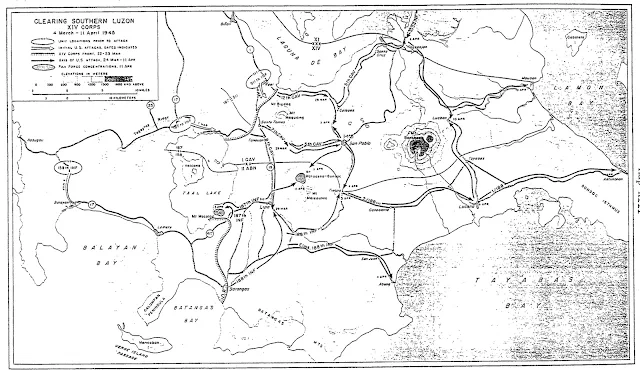
Map of World War II US Troops’ Movements in Batangas in March-April 1945
The map below shows the movement of United States Army troops in Batangas in early 1945. Its title is “Clearing Southern Luzon XIV Corps.” Most of the movements shown in the map, however, pertained to those of the 11th Airborne Division, a.k.a “Angels,” the exploits of which are serialized in Batangas History based on the book written by Edward Michael Flanagan1.
The map was extracted from a thesis of David Wayne Dengler entitled “The Small Change of Soldiering: the 188th Glider Infantry Regiment2” written in 1998 and presented to the University of Nebraska.
 |
| Extracted from David Wayne Dengler's 1998 thesis "The Small Change of Soldiering: the 188th Glider Infantry Regiment." |
Readers and researchers who wish to obtain a better contextual grasp of the map are advised to download Dengler’s thesis from the Internet Archive. A link is provided in the Notes and references section below.
Those who wish to know more about the exploits of the 11th Airborne Division as described by Flanagan may download his book from the Internet Archive. A hyperlink is also provided in the section below. Alternatively, those who wish to be limited to the division’s movements in Batangas only may find the series of articles archived under the World War II section of the main menu at the top of this page.
2 “The Small Change of Soldiering: The 188th Glider Infantry Regiment,” by David Wayne Dengler, 1998, a thesis presented to the University of Nebraska, online at the Internet Archive.
