Maps Showing Damage Caused by the 1911 Eruption of Taal Volcano
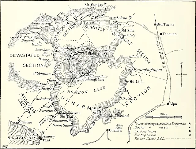
The map below has been extracted from the 1912 compilation of The National Geographic Magazine. It was part of a lengthy pictorial essay that detailed the devastating 1911 eruption of Taal Volcano, among the most violent on record.
In the magazine edition, the map above was labeled: “Map showing area of devastation by the last eruption of Taal Volcano and also the towns destroyed by the previous eruptions.”
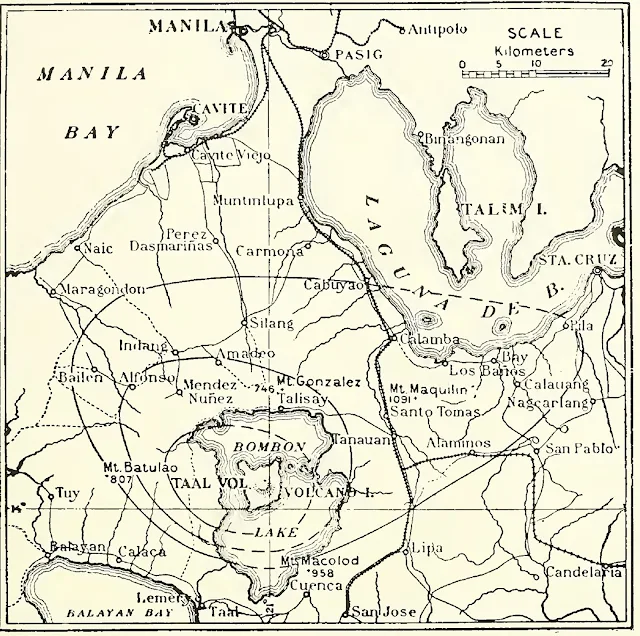
Below, extracted from the adjoining page, is a second map with this caption: “Map of the region affected by the great eruption of January 30, 1911.”
Notes and references:
1 “The National Geographic Magazine: an Illustrated Monthly, Volume 23,” published 1912 in the United States of America.
In the magazine edition, the map above was labeled: “Map showing area of devastation by the last eruption of Taal Volcano and also the towns destroyed by the previous eruptions.”
 |
| Image source: 1912 The National Geographic Magazine compilation. |
Below, extracted from the adjoining page, is a second map with this caption: “Map of the region affected by the great eruption of January 30, 1911.”
 |
| Image source: 1912 The National Geographic Magazine compilation. |
Notes and references:
1 “The National Geographic Magazine: an Illustrated Monthly, Volume 23,” published 1912 in the United States of America.
